


Unlock a new level of precision, efficiency, and reliability in aerial data collection with the DJI Mavic 3 Enterprise Thermal Drone Survey Bundle. This all-in-one solution is designed for professionals in surveying, construction, inspection, public safety, agriculture, and other critical industries where thermal imaging, centimeter-level accuracy, and high-quality mapping are essential.
This powerful bundle includes the DJI Mavic 3 Enterprise Thermal Drone, the RTK Module for high-precision georeferencing, the DJI D-RTK 2 Mobile Station with tripod, and a 1-year subscription to DJI Terra—DJI’s premium mapping and modeling software. It’s everything you need to take command of advanced aerial missions with confidence and speed.
🔍 Professional Imaging with Dual Camera System
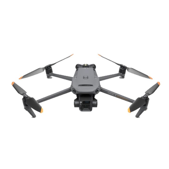
The DJI Mavic 3T (Thermal) is built for mission-critical applications, offering a powerful combination of wide-angle, telephoto, and thermal sensors. Whether you’re capturing structural data, performing utility inspections, or conducting emergency response, this drone adapts to the most demanding workflows.
Wide Camera
-
4/3-inch CMOS sensor for exceptional clarity
-
20MP resolution delivers rich detail
-
Mechanical shutter eliminates motion blur during fast mapping flights
-
Ideal for surveying, photogrammetry, and mapping
Telephoto Camera
-
12MP resolution with 162mm equivalent focal length
-
56× hybrid zoom allows safe and detailed inspection from a distance
-
Perfect for infrastructure inspections, wildlife monitoring, and hazard assessment
Thermal Imaging Camera
-
Accurate thermal readings for search and rescue, solar panel inspection, firefighting, and more
-
Identify heat signatures, structural faults, and hotspots even in total darkness
📡 Precision Mapping with RTK Integration
The included DJI Mavic 3 Enterprise RTK Module delivers centimeter-level positioning accuracy, essential for high-precision applications like geospatial mapping, surveying, and volume calculation.
RTK Module Specs:
-
Horizontal Accuracy: 1 cm + 1 ppm
-
Vertical Accuracy: 1.5 cm + 1 ppm
-
Low-power and high-stability RTK link for consistent performance in field conditions
The module integrates seamlessly with DJI’s RTK network and the D-RTK 2 Mobile Station for full GNSS correction data—perfect for workflows requiring highly accurate ground control.
🛰️ D-RTK 2 Mobile Station – Your On-Site GNSS Powerhouse
This high-precision mobile GNSS station ensures real-time correction data for your drone, enhancing positional accuracy to centimeter levels in real-time. Built for rugged field use, the D-RTK 2 Station is IP65-rated, durable, and easily connects with multiple drones simultaneously.
Key Features:
-
High-precision 6-axis IMU for movement and slope monitoring
-
Electronic bubble level for precise calibration
-
Simultaneous multi-drone operation
-
Weather-resistant and mobile field tripod included
Whether you’re working in remote areas or large-scale industrial sites, this mobile base station ensures your fleet stays connected and accurate.
🧭 Advanced Mapping with DJI Terra (1-Year License Included)
Create accurate 2D and 3D models, perform automated flight planning, and generate georeferenced maps with DJI Terra software. Tailored for enterprise users, it offers complete integration with the DJI ecosystem, simplifying workflows and reducing mission time.
Software Highlights:
-
Real-time 2D mapping and full-resolution 3D reconstructions
-
Seamless flight planning for complex surveying routes
-
Supports multi-layer inspection workflows
-
Optimized for all DJI Enterprise drones
📦 What’s Included in the DJI Mavic 3 Enterprise Thermal Drone Survey Bundle
-
1× DJI Mavic 3 Enterprise Thermal Drone
-
1× DJI Mavic 3 Enterprise RTK Module
-
1× DJI D-RTK 2 Mobile Station with Tripod
-
1× DJI Terra Mapping Software – 1 Year Subscription
-
3× DJI Propeller Pairs
-
1× DJI Intelligent Flight Battery
-
1× DJI Battery Charger & Power Cable
-
1× USB-C Cable
-
1× Enterprise-grade Protective Carry Case
Everything is included to help your team deploy faster, operate longer, and deliver results with professional accuracy.
🛠️ Built for Critical Applications Across Industries
Whether you’re a land surveyor, utility inspector, emergency responder, or agriculture professional, the DJI Mavic 3T Enterprise Thermal Drone Bundle is your go-to solution for accurate, real-time data collection and situational awareness.
-
Conduct search & rescue missions in low-light or high-risk areas
-
Perform solar and electrical inspections with high-resolution thermal imaging
-
Create detailed maps and models for construction, mining, and land development
-
Improve disaster response with real-time aerial insights
✅ Why Choose This Bundle?
-
All-in-one enterprise drone solution
-
Centimeter-level accuracy with RTK + D-RTK 2
-
Seamless integration with DJI Terra mapping software
-
Dual-sensor payload with thermal imaging
-
Reliable performance in challenging environments
Dominate the skies with unmatched thermal insight and geospatial precision. The DJI Mavic 3 Enterprise Thermal Drone Survey Bundle gives you the tools, accuracy, and software needed to deliver professional results in every mission.


Reviews
There are no reviews yet.